Monday, January 11, 2016

2016 Howard Beye Winter Hike

The weather has been extremely mild for winter in Western New York.  It was a very warm December.  I had planned on going hiking on January 1st to do a first day hike.  However, the weather was not mild that day and it snowed a lot.  Where I had planned on going was at the end of a dirt road and I didn't want to get my car stuck.  It wasn't hiking in the snow that would have been the problem, it was driving in the snow.

So I wasn't sure when I'd be able to go hiking again, but then I got an email from the FLT Conference reminding people that the 2016 Howard Beye Winter Hike would be Saturday, January 9th.  My mom has been telling me that she wishes I wouldn't hike alone and that I should find a group.  The weather looked good and the part of the trail was only an hour and a half away.  So I contacted to coordinator and Saturday morning I drove down to Bath, NY.

The group met at the Hickory Hill Campground.  It was a really nice campground that I'd be interested in going back to.  There's also a side trail that meets the FLT/NCT from the campground.  The guy in the gift shop was also willing to use the camp van to transport us to the trailhead if needed.  I left my car at the campground and hitched a ride with someone.
Getting Ready at the Trail Head
I'm in the blue jacket right behind the car.

We started the hike on the Bristol Hills Trail, a branch trail of the main FLT.  It was a huge hill where we started and I had to stop several times going up.  Many other people did too, but I quickly moved to the back of the pack.

Trail Going Uphill
The hike was 3.6 miles on the Bristol Hills Trail and then we hit the main Finger Lakes Trail/North Country Trail.  We stopped for lunch at the junction.  There was also a dead coyote there (I didn't take a picture).

Snowy Trail
Selfie with Trail Maker
We finished the hike on 2.1 miles of the main FLT/NCT.  We had cars at the end or we could have continued walking on the trail to the campground.  I was tired so I hitched a ride back to my car.  It was only mid afternoon but I was exhausted.
View of a Lake
It was a lot of fun and I'm really glad I did it.  I'm not so sure that hiking with a group is any better or worse.  I hiked my own hike and for much of the time I was by myself.  I just knew that there were people in front of and behind me.  It was nice to talk to other people who enjoyed hiking.

Several people mentioned the County Hike Series that the FLT Conference does throughout the Spring and Summer.  This year they are doing it in Catteragus County.  If I complete that I will have completed 96 miles of the FLT/NCT this year.  My goal is 100 miles this year for the North Country Trail Hike 100 Challenge.  Now I have 2.1 miles!

Sunday, September 20, 2015

Mt. Tuscarora

Yesterday I left to spend the day hiking on the FLT starting at the start of the trail in Pennsylvania.  I checked the weather forecast and it said said cloudy with showers in the late afternoon.  I planned on hiking 5 miles in and then turning around and hiking back to my car.  I'd also take a detour from the FLT to the fire tower on Mt. Tuscarora.  However, plans quickly changed.  It rained the minute I got in the car to leave Attica and all the way to the trail head.  There was no service at the trail head so I couldn't check the weather to see if and how long the rain would last.  So I figured I'd just go into the woods and maybe the rain wouldn't be so bad.
Standing in the Rain
It was bad.  I was soaked within 5 minutes I didn't even make it to the Pennsylvania-New York line.  I gave up and turned around and went back to the car.
The Trail in the Rain
I tried to think of what to do next.  I was soaked but I also drive two hours to get there.  So much for the weatherman saying it wouldn't be a wash out.  I decided I'd go into Allegany State Park.  I figured I could walk up to the Stone Tower because there was a parking lot close to it and the day wouldn't be a total loss.  The minute I got to the park entrance it stopped raining.  The lady at the booth said I brought the sunshine.  So I entered the park and found the trail head to the Mt. Tuscarora Fire Tower.
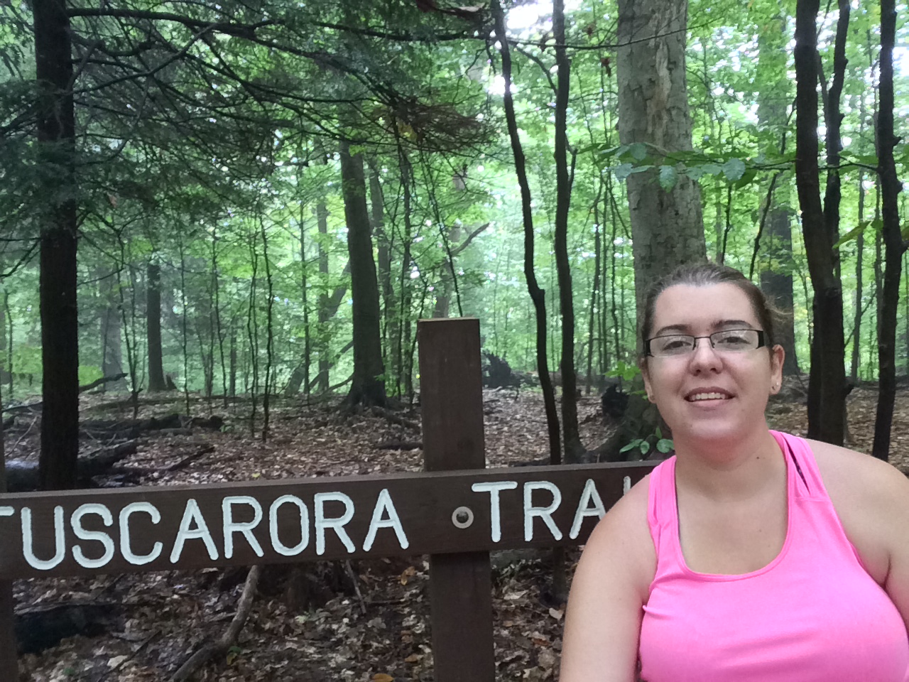
Sign at Trail Head
Based on the map I had on my phone, I thought it was straight up the trail and then the fire tower would be there.  I was wrong and it was 2.5 miles with a good portion of it being straight uphill.  According to the internet the first 0.9 of a mile rises over 640 feet in elevation.  It was a rough climb for me because I was getting the start of head cold.  I was so winded and had to stop several times.
Looking Down the Trail

Blue Trail Blazes
While I was resting at one point, a 4-point buck passed the trail ahead of me.  I tried to get a picture, but he noticed me before I could get a picture.  I kept thinking I missed the fire tower because I knew it wasn't it an open area.  I also thought it should be straight up the mountain.  Well I finally realized that I was not in the spot I thought I was and that I had to go quite a distance before I got to the fire tower.  It finally leveled out and made hiking a little easier.
Mt. Tuscarora Fire Tower

Me with the Fire Tower

View from Below
The tower is now in disrepair.  The bottom set of stairs has been removed (I saw half of it laying below the tower).  They also removed all the platforms between stairs and at the top of the tower.  The structure was really rusty and I don't know if I would have climbed it if I could. 

I decided I didn't want to hike back the same way I came.  There was an unmarked trail that went straight down.  It was the one I thought I was going up to begin with.  However, there were a lot of fallen trees and I quickly lost it.  So I back tracked and continued down the trail.  It eventually met up with the NCT/FLT but then continued back to the road.
NCT to Pennsylvania

Mt. Tuscarora Trail
It was a nice trip back to the road.  I passed some creeks and just nice scenery in the woods.
White and Blue Blazes


At the end of the trail was one of the camp general stores.  I was able to get an ice cold Snapple and a candy bar which was delicious.  Since I didn't want to hike back up and down the mountain, I took the road back to my car.  It was hot and muggy by then.  I took several breaks on my way to rest because my feet were blistering and my back pack was feeling heavy.
Quaker Lake
Shortly after I took the above picture I started walking again.  I figured I had a mile to go to my car.  One of park maintenance guys asked if I wanted a ride back to the Tuscarora trail head.  I told him I only had a mile left and I went this far I could continue.  He said usually people are exhausted at that point.  If it was raining again, I would have totally taken the ride.

Since I paid the $6 admission into the park I wanted to see more before I left.  I drove through the park and went to the stone tower.  I thought this was the second fire tower that the park had, but they actually have a second metal structure.  I was to tired to walk to the second one, though.
Selfie from the Top of the Stone Tower


Panoramic from the Stone Tower


Stone Tower
The Stone Tower was built as part of President Roosevelt's New Deal.  It was completed in November 1933 and used to observe nature from the top.  There's an arrow carved in the top that points north.  It was recently restored, removing the graffiti, however people still don't care and have been leaving their mark on the tower.

It was a long day and it was nice to get home and shower.  I was sweaty and still damp from the early morning drenching.  I still had fun and want to go back to explore more of Allegany State Park.

Sunday, September 13, 2015

Half Marathon

My plan was to go for a hike on Labor Day.  I thought it would be a perfect way to end the summer.  I'd be doing a half marathon on Sunday and I thought I would be ok on Monday to go for a hike.  I was dead wrong.

Jodi and I have been training all summer for this half marathon.  I think I hyped myself up saying I could do this and run most of it.  Well, I was dead wrong.  I was not ready and it was super hot.  the combination did not make running or even walking it easy.  Jodi and I ended up walking most of it and by the end we were exhausted and hurting.  I could barely move the next day.
Waiting for the race to start.

Buffalo Love

Crossing the Finish Line
Finisher Medals

If I ever did a half marathon again, I would do the Biggest Loser again.  Besides it being Labor Day Weekend and hot, it is great for slow people like me.  I definitely need more training though so it will be a while before I do it again.  I'll stick to 5Ks for a while.

Monday, September 7, 2015

Wild: From Lost to Found on the Pacific Crest Trail

Strayed, Cheryl.  Wild: From lost to found on the Pacific Crest Trail.  New York: Alfred A. Knopf, 2012. 338. Print.


After the death of Cheryl's mother, Cheryl is destroyed by grief.  Her family is broken, her marriage failing, and she's doing heroine.  On an impulse she decides to hike the Pacific Crest Trail through California and Oregon, with no training.  She hopes to find herself in the wild.  "How wild it was, to let it be."


My Feelings:
This was the second book I have read about hiking this summer and it was a very different book than Grandma Gatewood's Walk.  The book is autobiographical and about the author's life after her mother's death.  She realizes she must do something before grief totally destroys her.  She hopes by walking the PCT that she will be able to find the answer.  I believe that the author did find what she was looking for on the PCT in addition to having the experience of a life time.


I enjoyed the book, but there were some things I did not like.  The author was somewhat annoying at times.  I thought that she was very self centered.  I know I haven't experience the grief that she has felt, but it was a lot about why her family wasn't together with her.  She also made such good friends during the hike but never found a way to contact them after the hike.


I know there are some people who don't like Cheryl Strayed and the popularity she has given to the PCT.  Everyone has their own hike to hike and I don't see why there is some controversy.  I wouldn't put the book on my top reads, but I'm not upset by Cheryl's story.

Saturday, September 5, 2015

Moss Lake


Went on a short hike with the my Mother-in-Law, niece, and nephew in Rushford, NY.  Moss Lake is a small nature sanctuary with a trail that goes around the lake. 
Everyone where I work is always talking about going to Moss Lake and seeing all the bull head. Apparently if you feed the fish with bread they swarm it. 

So we went this morning because we had time to kill before going to the Rushford Labor Day Demolition Derby. I brought both of the older kids but they talked the whole time. In the past they only walked to the board walk and complained about doing the whole loop. I'm not sure of the distance of the whole loop but it was probably around a mile. 

When we first got there we didn't see any bull head. We walked the trail to the little bridge and found two slices of bread someone left. We tried a few pieces at the bridge but no luck attracting the fish. 
The trail was a nice trail. Sometimes it had blazes but most of the time it didn't, but it was a well traveled path.
For wildlife we saw some frogs, lots of chipmunks, and geese. The geese are most of our bread.
At the end of our hike, which was also the beginning, another family came with bread. We ended up seeing some bull head but nothing like pictures people have shown me. We also saw a snapping turtle, which we think is the reason why we didn't see many fish. Even the geese gave him a wide berth.

I'm going to end my entry with a panorama of Moss Lake:

Thursday, August 27, 2015

Holland Ravines

It's the last week before I go back to work for the school year and I wanted to go hiking as much as possible.  However, so far I've only been able to go once.  Maybe I will be able to get another hike in this weekend when I'm down in Rushford.

So I wanted to do another Passport hike.  My goal is to get the West Passport program done before hunting seasons starts.  You need to complete 4 Passport hikes in order to earn the badge and after today's hike and the Swift Hill Hike, I will have 2 completed.

I also wanted to bring someone with me so I brought my nephew.  I decided to do a hike about 30 minutes away from my house.  Looking at the Passport brochure the Holland Ravines looked like a fun hike for both me and my nephew.  The Holland Ravines are part of the Conservation Branch of the FLT and this part is managed by the Foothills Trail Club.  It was also the memorial section of Art and Olga Rosche who were founding members of the Foothills Trail club.
Sign at Trail Register
I was a little nervous about parking because when I looked at google maps, the trail access was in a residential area.  I had to park on the shoulder but there wasn't a lot of room so I was half on the road and half on the shoulder.  Even though it was a residential neighborhood, the trail was well marked and it wasn't super populated, it was in a very rural area of Erie County.
Conservation Trail Sign
The trail started out following a horse pasture but we quickly got to the ravines.  The Conservation Trail is on private property in this section, but there were a lot of posted signs throughout.  The trail followed orange blazes but there were times when the orange blazes went beyond a ton of posted signs.  I was understanding that if we stayed on the trail we'd be ok and that's what I planned to tell anyone if they questioned me.  There was also a lot of four-wheeler trails that made it confusing to follow the trail.  We had to turn around a couple of times because we lost the trail.
Nice section of the trail but very few blazes.
The trail was 3.8 miles out and back and besides the several ravines, it was pretty level.  It seemed a lot longer going than coming.  My nephew did pretty good.  He was getting tired but at the turnaround point we stop and ate lunch so it gave him a second wind.
My Nephew and I in the First Ravine
Another Ravine
Another reason I was attracted to this hike was because the brochure said there was "an outdoor museum of retired farm equipment."  Well, we never found any farm equipment, but after we passed a field of Christmas trees we found an abandoned jeep.  It was disappointing.
Abandoned Jeep
This was my first hike on the Conservation Trail.  After completing the Holland Ravines I have completed 1% of the Conservation Trail.  I've also completed 1.8% off all the branch trails.
Orange Newt We Saw

Tuesday, August 25, 2015

Grandma Gatewood's Walk


Montgomery, Ben. Grandma Gatewood's Walk: The Inspiring Story of the Woman Who Saved the Appalachian Trail. Chicago: Chicago Review, 2014. 288. Print.

Emma Gatewood was the first woman to hike the Appalachian Trail solo.  She did it in 1955 at the age of 67.  Grandma Gatewood became a celebrity after hiking the trail because of how she did it.  She didn't prepare or have special equipment.  She just decided to go for a walk.  She started the trail with tennis shoes and a homemade backpack.  She met many people on her trip and make it from Georgia to Maine that helped her on the way.  She was also met by many reporters that helped make her trip famous.  She would hike the AT two more times after her first solo hike with nothing more than her homemade backpack and a few other supplies.

My Feelings:
I found this book through the New York Public Library (NYPL) and their online ebooks.  I was originally looking for A Walk in the Woods by Bill Bryson but it wasn't available (I'm still waiting to borrow it).  I just needed a book about the AT and this was the only one I could get immediately.

I enjoyed this book.  It was interesting to hear Grandma Gatewood's backstory in addition to the story of her hiking the AT.  It wasn't an amazing book because a lot of what the author was saying was speculation.  He wrote the book by talking with Emma Gatewood's children and looking at her journals.  There were some direct quotes, but he made it seem like he knew exactly what she was thinking and the reason why she decided to go for a hike.  I find it hard to believe that she felt exactly like Ben Montgomery stated.  I feel like Emma Gatewood would not have let the world know exactly what she was thinking.

Another problem I had with this book is that it is "The Inspiring Story of the Woman Who Saved the Appalachian Trail."  The book hardly talks about that and that was not Emma's goal in hiking the AT.  She did comment on some of the poor spots of the trail that needed to be better maintained, but she did not wake up and say "I'm going to advocate for the AT."  I think that the book didn't do a good job living up to its title.  She may have had some influence but I don't the trail would have disappeared without her.

Overall, it was a good read about one woman's hike on the AT.